Category:Easton, Norfolk
Jump to navigation
Jump to search
English: Easton is a small village in Norfolk, to the west of Norwich. It covers an area of and had a population of 1,141 in 445 households as of the 2001 census. Located close to the Norfolk Showground and the A47, it also houses Easton College, a large agricultural college.
village and civil parish in Norfolk, UK  Eglwys Sant Pedr, Easton | |||||
| Upload media | |||||
| Instance of | |||||
|---|---|---|---|---|---|
| Location | South Norfolk, Norfolk, East of England, England | ||||
| Area |
| ||||
| Different from | |||||
 | |||||
Subcategories
This category has the following 3 subcategories, out of 3 total.
Media in category "Easton, Norfolk"
The following 118 files are in this category, out of 118 total.
-

-
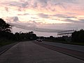
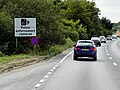
 A47 - geograph.org.uk - 4361942.jpg 640 × 426; 47 KB
-
 A47 - geograph.org.uk - 4361951.jpg 640 × 426; 41 KB
-
 A47 - geograph.org.uk - 4362034.jpg 640 × 426; 42 KB
-
 A47 - geograph.org.uk - 4371009.jpg 640 × 426; 29 KB
-
 A47 at Easton - geograph.org.uk - 5092206.jpg 3,072 × 2,304; 1.81 MB
-
 A47 at Easton - geograph.org.uk - 5092208.jpg 3,072 × 2,304; 1.82 MB
-
 A47 near Easton - geograph.org.uk - 4726554.jpg 640 × 480; 371 KB
-
 A47 west of the roundabout at Easton - geograph.org.uk - 4281387.jpg 800 × 536; 84 KB
-
 A47 Westbound near to Easton - geograph.org.uk - 4726551.jpg 640 × 480; 391 KB
-
 A47, eastbound - geograph.org.uk - 4371015.jpg 640 × 426; 38 KB
-
 A47, eastbound - geograph.org.uk - 4371017.jpg 640 × 426; 37 KB
-
 A47, eastbound - geograph.org.uk - 4371020.jpg 640 × 426; 37 KB
-
 A47, eastbound - geograph.org.uk - 4371025.jpg 640 × 426; 34 KB
-
 A47, eastbound - geograph.org.uk - 4371031.jpg 640 × 426; 38 KB
-
 A47, westbound - geograph.org.uk - 4361916.jpg 640 × 426; 53 KB
-
 A47, westbound - geograph.org.uk - 4361926.jpg 640 × 426; 59 KB
-
 A47, westbound - geograph.org.uk - 4361933.jpg 640 × 426; 51 KB
-
 Bawburgh Rd - geograph.org.uk - 4325081.jpg 640 × 430; 83 KB
-
 Bawburgh Rd - geograph.org.uk - 4325082.jpg 640 × 430; 82 KB
-
 Bawburgh Rd - geograph.org.uk - 4325083.jpg 640 × 430; 94 KB
-
 Water Pump - geograph.org.uk - 1257248.jpg 480 × 640; 118 KB
-
 Bracken growing at Ringland Hills - geograph.org.uk - 2569219.jpg 640 × 480; 298 KB
-
 Broom Farm - geograph.org.uk - 5611081.jpg 1,600 × 1,200; 315 KB
-
 Broom Lane - geograph.org.uk - 3418192.jpg 3,072 × 2,304; 1.34 MB
-
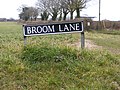 Broom Lane sign - geograph.org.uk - 3418174.jpg 3,072 × 2,304; 1.61 MB
-
 Bungalow in Marlingford Road, Easton - geograph.org.uk - 1903364.jpg 640 × 480; 105 KB
-
 Bus shelter in Dereham Road, Easton - geograph.org.uk - 1903385.jpg 640 × 618; 138 KB
-
 Chez Denis in Dereham Road, Easton - geograph.org.uk - 1903376.jpg 640 × 480; 92 KB
-
 Chez Denis ^ Marlingford Road - geograph.org.uk - 3418733.jpg 3,072 × 2,304; 1.28 MB
-
 Conservation advise - geograph.org.uk - 3016451.jpg 2,560 × 1,920; 987 KB
-
 Dereham Road - geograph.org.uk - 3418749.jpg 3,072 × 2,304; 1.22 MB
-
 Dereham Road, Easton - geograph.org.uk - 1903379.jpg 640 × 480; 103 KB
-
 Dereham Road, Easton - geograph.org.uk - 3418745.jpg 3,072 × 2,304; 1.28 MB
-
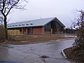
 Easton College - geograph.org.uk - 3418151.jpg 3,072 × 2,304; 1.32 MB
-
 Easton College - geograph.org.uk - 5611070.jpg 1,600 × 1,293; 327 KB
-
 Easton College - geograph.org.uk - 5611076.jpg 1,600 × 1,200; 398 KB
-
 Easton College entrance - geograph.org.uk - 3418195.jpg 3,072 × 2,304; 1.26 MB
-
 Easton College sign - geograph.org.uk - 3418131.jpg 2,304 × 3,072; 1.23 MB
-
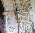
 Easton St Peter's church - geograph.org.uk - 2212589.jpg 640 × 480; 128 KB
-
 Easton Village sign - geograph.org.uk - 3418746.jpg 2,304 × 3,072; 1.38 MB
-
 Easton Village sign - geograph.org.uk - 3418747.jpg 2,304 × 3,072; 1.65 MB
-
 Electricity Transmission Lines ^ Pylon off the A47 - geograph.org.uk - 5092226.jpg 3,072 × 2,304; 1.95 MB
-
 Entering Easton on Marlingford Road - geograph.org.uk - 3418700.jpg 3,072 × 2,304; 1.22 MB
-
 Entrance to Easton College - geograph.org.uk - 3418177.jpg 3,072 × 2,304; 1.54 MB
-
 Field entrance off the A47 - geograph.org.uk - 5092217.jpg 3,072 × 2,304; 1.87 MB
-
 Field west of Sandy Lane, Ringland Hills - geograph.org.uk - 2569238.jpg 640 × 480; 201 KB
-
 Fields and marshes, Bawburgh - Easton - geograph.org.uk - 77107.jpg 640 × 480; 69 KB
-
 Football pitch, Easton Park - geograph.org.uk - 5611060.jpg 1,600 × 1,200; 444 KB
-
 Frost on the grass in the Tudd Valley - geograph.org.uk - 6029072.jpg 3,264 × 2,448; 1.72 MB
-
 Hall Road sign - geograph.org.uk - 3418721.jpg 3,072 × 2,304; 1.64 MB
-
 Hall Road, Easton - geograph.org.uk - 3418718.jpg 3,072 × 2,304; 1.39 MB
-
-
 Layby on the A47 - geograph.org.uk - 3418751.jpg 3,072 × 2,304; 1.21 MB
-
 Layby on Westbound A47 - geograph.org.uk - 4726559.jpg 640 × 480; 400 KB
-
 Lichens and mosses - geograph.org.uk - 1903661.jpg 480 × 640; 213 KB
-
 Marlingford Road - geograph.org.uk - 3418126.jpg 3,072 × 2,304; 1.29 MB
-
 Marlingford Road sign - geograph.org.uk - 3418742.jpg 3,072 × 2,304; 1.64 MB
-
 Marlingford Road ^ Easton Village sign - geograph.org.uk - 3418740.jpg 3,072 × 2,304; 1.31 MB
-
 Marlingford Road, Easton - geograph.org.uk - 1903368.jpg 640 × 480; 96 KB
-
 Marlingford Road, Easton - geograph.org.uk - 3418703.jpg 3,072 × 2,304; 1.31 MB
-
 Muddy lane - geograph.org.uk - 2115462.jpg 1,280 × 960; 366 KB
-
 New hedge adjacent road, near Easton - geograph.org.uk - 2527299.jpg 640 × 480; 138 KB
-
 New Sports ^ Conference Centre at Easton College - geograph.org.uk - 3418144.jpg 3,072 × 2,304; 1.37 MB
-
 Norwich 5 Dereham 11 - geograph.org.uk - 1178797.jpg 640 × 480; 119 KB
-
 Norwich 6 Dereham 10 - geograph.org.uk - 1178766.jpg 640 × 480; 111 KB
-
 Old Milestone - geograph.org.uk - 1178790.jpg 480 × 640; 115 KB
-
-
 On their way to Yorkshire - geograph.org.uk - 5104651.jpg 640 × 615; 421 KB
-
 Pastures south of Bawburgh Road - geograph.org.uk - 5325919.jpg 640 × 480; 412 KB
-
 Path in Stonyhole Plantation, Ringland - geograph.org.uk - 2569228.jpg 640 × 480; 314 KB
-
 Rest stop beside the A47 road - geograph.org.uk - 5104645.jpg 640 × 480; 297 KB
-
 Ringland Road, Lower Easton - geograph.org.uk - 2365252.jpg 3,072 × 2,304; 1.44 MB
-
 Ringland Road, Lower Easton - geograph.org.uk - 3672002.jpg 3,072 × 2,304; 1.35 MB
-
 Ringland Road, Lower Easton - geograph.org.uk - 3672025.jpg 3,072 × 2,304; 1.35 MB
-
 Ringland Road, Lower Easton - geograph.org.uk - 3672029.jpg 3,072 × 2,304; 1.5 MB
-
 Road at Easton College - geograph.org.uk - 3418154.jpg 3,072 × 2,304; 1.31 MB
-
 Roundabout, A47 - geograph.org.uk - 4361945.jpg 640 × 426; 50 KB
-
 Safety First - geograph.org.uk - 975422.jpg 640 × 480; 50 KB
-
 Small cattle pen in pasture - geograph.org.uk - 5325921.jpg 640 × 480; 400 KB
-
 Snack Van in Layby on Westbound A47 - geograph.org.uk - 4726544.jpg 640 × 480; 356 KB
-
 St Peter's church in Easton - benchmark - geograph.org.uk - 1903653.jpg 640 × 515; 154 KB
-
 St Peter's church in Easton - geograph.org.uk - 1903629.jpg 640 × 505; 122 KB
-
 St Peter's church in Easton - geograph.org.uk - 1903634.jpg 640 × 480; 126 KB
-
 St Peter's church in Easton - geograph.org.uk - 1903640.jpg 640 × 480; 113 KB
-
 St Peter's church in Easton - geograph.org.uk - 1903647.jpg 640 × 487; 157 KB
-
 St Peter's church in Easton - geograph.org.uk - 1903691.jpg 293 × 640; 56 KB
-

-
 St Peter's church in Easton - memorial - geograph.org.uk - 1903681.jpg 640 × 535; 178 KB
-

-
 St Peter's church in Easton - memorial - geograph.org.uk - 1903687.jpg 480 × 640; 121 KB
-
-

-

-

-
 St Peters Church - geograph.org.uk - 2115424.jpg 1,280 × 960; 271 KB
-
 St. Athanasius Coptic Orthodox Church - geograph.org.uk - 5611055.jpg 1,600 × 1,200; 560 KB
-
 Stonyhole Plantation, Ringland - geograph.org.uk - 2569231.jpg 640 × 480; 321 KB
-
 That was a tower, that was - geograph.org.uk - 2115453.jpg 1,280 × 960; 459 KB
-
 Three Cornered Plantation from Barford Road - geograph.org.uk - 6001704.jpg 4,608 × 3,456; 6.54 MB
-
 Thwaite's Hills at Ringland Hills - geograph.org.uk - 6029066.jpg 3,264 × 2,448; 1.77 MB
-
 Tree by Marlingford Road - geograph.org.uk - 5611071.jpg 1,600 × 1,200; 517 KB
-
 View across cattle pasture - geograph.org.uk - 667176.jpg 640 × 480; 161 KB
-
 View along Dereham Road, Easton - geograph.org.uk - 1903373.jpg 640 × 491; 113 KB
-
 View along Marlingford Road, Easton - geograph.org.uk - 1903358.jpg 640 × 480; 105 KB
-

-
 Village Sign - geograph.org.uk - 1257241.jpg 480 × 640; 114 KB
-
 Westbound A47 - geograph.org.uk - 4726571.jpg 640 × 480; 421 KB
-

-
 Westbound A47 at Easton - geograph.org.uk - 4726565.jpg 640 × 427; 389 KB
-
 Westbound A47 near to Easton - geograph.org.uk - 4726549.jpg 640 × 427; 334 KB
-
 Western Road, Lower Easton - geograph.org.uk - 3672004.jpg 3,072 × 2,304; 1.44 MB
-
 Wetland in the Yare Valley from Barford Road - geograph.org.uk - 6001700.jpg 4,608 × 3,456; 6.32 MB
-
 Where Dog Lane ends - geograph.org.uk - 667191.jpg 640 × 480; 149 KB
-
 Where two tracks meet - geograph.org.uk - 667174.jpg 640 × 480; 173 KB
-
-
 Winter Wheat, Wood, Water Tower - geograph.org.uk - 1902228.jpg 640 × 480; 34 KB
-
 Dog Lane - geograph.org.uk - 667188.jpg 480 × 640; 191 KB


_-_geograph.org.uk_-_1903663.jpg)
_-_geograph.org.uk_-_1903665.jpg)


